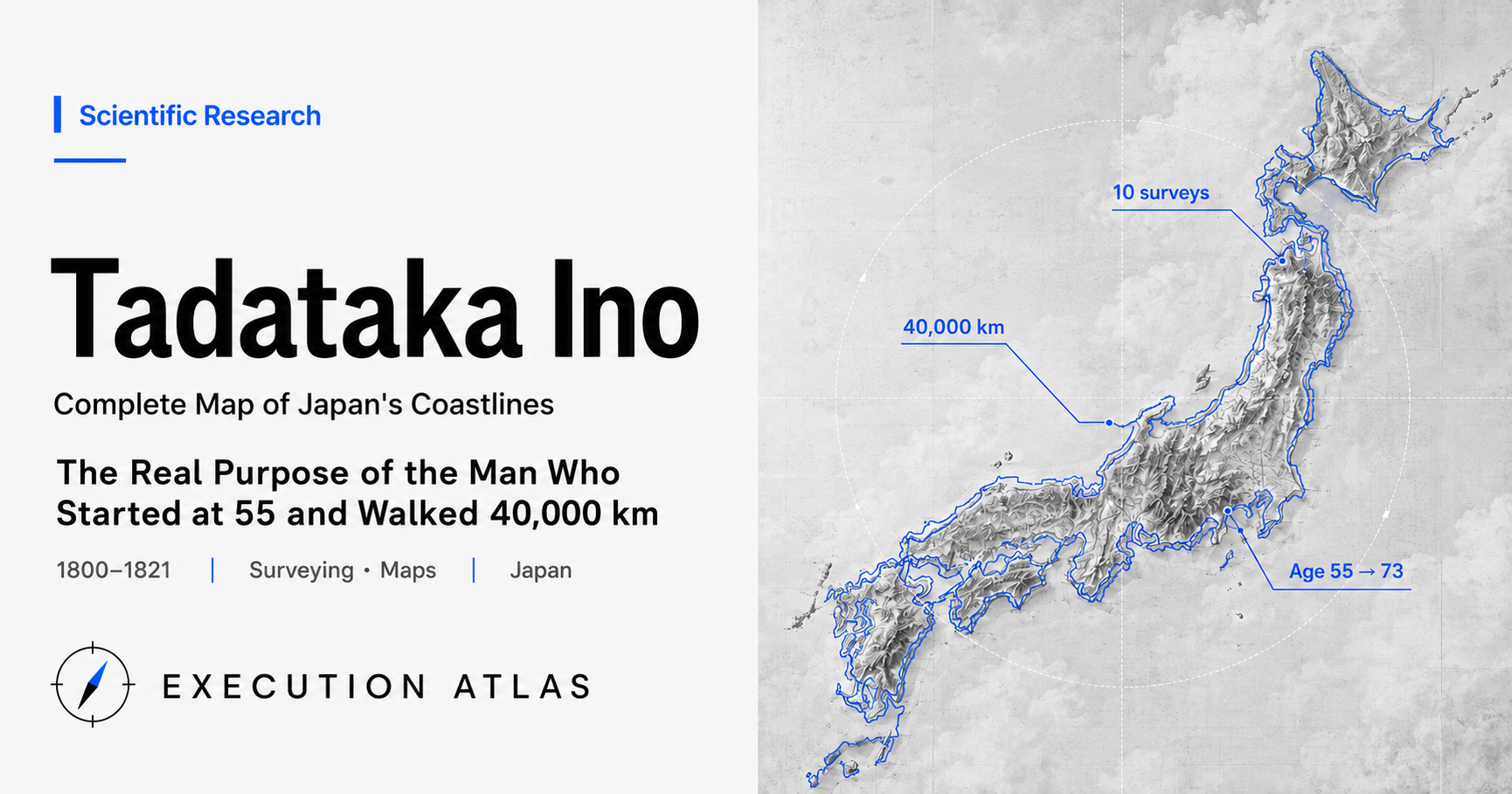
Ino Tadataka set out on his first survey expedition on the intercalary 19th day of the 4th month of 1800 — he was 55. He walked from Edo to the southern coast of Ezo and back. Hundreds of kilometers each way, measured on foot. It took roughly 180 days.
For the next 16 years — until he died at 73 — Tadataka kept walking. The second survey, third, fourth, and so the numbers climbed until the tenth concluded the mapping enterprise. Total distance: approximately 40,000 kilometers. Equivalent to the circumference of the Earth. Multiply the arc length of one degree of meridian — calculated by Tadataka himself from his survey data — by 365, and you get the distance he walked. A man who walked the circumference of the Earth in order to measure its size.
The map was never finished. Tadataka died in 1818. His disciples concealed his death for three years to preserve the project’s budget, and in 1821 Takahashi Kageyasu presented the Dai Nihon Enkai Yochi Zenzu (Complete Map of the Coastal Areas of Japan) to the shogunate. Twenty-one years from the start — three years after Tadataka’s death.
Read at face value, this is a story about a Japanese map. But for Tadataka himself, the primary purpose was not the map. It was the arc length of one degree of meridian — the size of the Earth.
Mission: A Map of Japan to Measure the Size of the Earth
Tadataka was born into a village headman’s family in Kozuke no Kuni Kosekimura (present-day Kujukuri-machi, Chiba Prefecture). At 17 he was adopted into the Ino family, brewers in Shimosa Sawara, whose fortunes had declined after successive generations without a capable head. Tadataka expanded beyond brewing into transport and finance, quadrupling revenues in ten years. As village headman, he opened the family’s stored rice to feed his neighbors during the Great Tenmei Famine. In 1794, at 49, he handed the family headship to his eldest son. His assets at retirement: 30,000 ryo — equivalent, by some estimates, to 3 billion yen today.
Up to this point, the story is that of a capable provincial merchant-headman of the Edo period. Here it bends.
From around age 45, Tadataka had been absorbed in calendar science and astronomy. He ordered books from across the country and read them on his own. The year after he retired — 1795 — he traveled to Edo and became a disciple of Takahashi Yoshitoki, the shogunate’s astronomer. Tadataka was 50; Yoshitoki was 32. A 50-year-old former merchant bowing before a scholar 18 years his junior.
Yoshitoki was the leading astronomer in Edo, the creator of the Kansei calendar. There was one question the two of them shared: how large is the Earth?
If you know the distance that corresponds to one degree of latitude, you can calculate the Earth’s circumference. At the time in Japan that value had not been established. The calendar scholars of Edo knew that if you measured the altitude of the North Star from two distant points and then measured the north-south distance between them, you could calculate the arc length of one degree. The two points should be as far apart as possible — hundreds of kilometers, ideally over a thousand.
There was no legitimate pretext for walking that distance with a measuring stick. Without a pretext, the shogunate would not issue travel permits. Tadataka and Yoshitoki thought it through. A survey of Ezo — that would fly.
In 1800, Tadataka petitioned the shogunate for permission to survey the southern coast of Ezo. The stated purpose was “a map for northern defense.” Russian ships had begun appearing in northern waters, and the shogunate could follow this logic easily. Permission was granted.
The stipend, however, was meager: 7 monme 5 bu of silver per day — perhaps 10,000 yen in modern terms. About 20 percent of the total cost. The other 80 percent came from Tadataka himself. A former great merchant with 30,000 ryo in assets — without that, the first step could never have been taken.
Design: Triple Verification and Phased Scope
Tadataka’s survey combined three independent measurement methods.
The first was the chain-traverse method. Measure distance by pace-counting, direction with a compass, connect them. The most basic form of plane surveying — but keeping stride length constant is difficult. Tadataka trained until 69 centimeters was etched into his body, maintaining it even on slopes.
The second was triangulation. Observe a distant common landmark from multiple survey stations, then correct the relative positions of those stations from the angular differences. The most frequently used landmark was Mount Fuji. In the Kanto and Tokai surveys, measurement lines from across Japan converged on a single point — Fuji — and errors were held in check.
The third was celestial observation. Using a precision instrument called a half-quadrant (radius 115 cm, fitted with a telescope), he measured the altitude of fixed stars. This gave latitude independently. Wherever accumulated error had crept into a measurement line, celestial observation would push it back with absolute coordinates.
Three measurements based on different principles. A single method lets errors accumulate; three independent systems mean that if one goes wrong, the other two detect it. The same logic as modern GPS using triangulation across multiple satellites. With Edo-period tools.
The other key design was a phased-scope strategy.
Tadataka never claimed, from the start, that he would survey all of Japan. The first expedition covered only the southern coast of Ezo. Walk there and back. Bring the results home, draw the map, show the shogunate. If the shogunate’s response was favorable, apply for the next survey.
After the first map was presented, the shogunate’s posture changed. From the second expedition onward, the project was reorganized as an official shogunate enterprise; Tadataka became a paid member of the Bureau of Astronomy. The stipend increased. The scope expanded: the northeastern Pacific coast, then the Tokaido, Hokuriku, Kinai, Chugoku, Shikoku, Kyushu, south to Tanegashima. Over 17 years, nearly all of Japan was covered in survey lines.
Had Tadataka applied from the beginning for “17 years of nationwide surveying at full government expense,” he would certainly have been refused. The Edo shogunate had no approval mechanism for a project of that length. He knew that.
Execution: A 69 cm Stride, 17 Years, 40,000 km
The first survey ran from the intercalary 19th day of the 4th month to the 21st day of the 10th month, 1800 — roughly 3,200 kilometers round-trip in 180 days. Just under 18 kilometers per day. Pace-counting and compass bearings by day; on clear nights, celestial observation until morning. Then walk again.
Modern long-distance walkers moving at a normal pace cover 20 to 25 kilometers per day. Tadataka’s 18 kilometers, including survey work, is a reasonable speed. They did it for six months without a break, from spring to autumn.
In subsequent surveys the team grew. Tadataka was joined by inner disciples, hired laborers, and porters — parties of about ten. One person took bearings, another counted paces, another recorded, another carried equipment. The division of labor was organized, but latitude observation remained Tadataka’s own work. On any clear night it was nearly a nightly task. Observe through the night, walk the next day, observe again. Sixteen years of this.
By the fifth expedition, the original main purpose — the arc length of one degree of meridian — had been settled. Tadataka’s calculated value differs from the currently known value by roughly one part in a thousand. Reaching that precision with pace-counting is remarkable in itself, but what is more striking than the measured figure is that after this answer arrived, Tadataka did not stop walking.
Tadataka’s own words survive:
“Studying astronomy and calendar science, and surveying the provinces — this is not to leave a name in posterity. It is, in either case, the heavenly mandate of nature.”
Having declared it was not for reputation, he walked for over ten more years. Not for reputation, then for what? Probably for the question itself, or for a way to spend his remaining time. His academic primary purpose had been achieved. The map-making work remained. The map had been the pretext for expanding the project’s scope — but for the 17th-year Tadataka, it had become work whose completion he needed to witness.
Chasing the schedule estimates is interesting. The first expedition’s records show no plan for a national survey. Tadataka probably did not foresee 17 years from the start. With each subsequent expedition, the scope expanded slightly. What was meant to finish in a few years had, without his noticing, stretched to over a decade. As the project proceeded, its full shape became visible. In Tadataka’s case, that expanding field of view matched almost exactly the length of time left in his life.
The tenth expedition, from 1815 into 1816, surveyed Edo city itself. Tadataka was 71. The map of the very city he had worked from was made last of all. Perhaps his body could no longer walk very far.
He died in 1818, at 73. The map was unfinished. Of the 214 large-scale sheets in the complete set, perhaps half had been completed. The rest were still being drafted.
People: The 50-Year-Old Apprentice, the Teacher 18 Years Younger, and the Son
Tadataka’s story turns on three relationships.
Ino Tadataka, born 1745. Traveled to Edo at 50 to become a disciple. Takahashi Yoshitoki, born 1764. Took the 50-year-old Tadataka as a disciple at 32. Takahashi Kageyasu, born 1785. Yoshitoki’s son. Tadataka’s grandchild in generation. He would complete the map.
Yoshitoki died in 1804 at 41 — 20 years younger than Tadataka, but he went first. It was the fourth year of the first survey; Tadataka had not yet reached the arc-length calculation that was his primary purpose. The teacher’s death must have been a blow to the mapping enterprise, but no expression of Tadataka’s feelings survives in the record. He simply continued surveying.
Kageyasu, at 19, inherited the Bureau of Astronomy in Yoshitoki’s place. To Tadataka he was the orphan of his teacher. From that point on, Kageyasu served as Tadataka’s patron, providing organizational support for the map’s production. The actual drafting was divided among Tadataka and his disciples (when they returned to Edo) and subordinates at the Bureau of Astronomy.
In 1818, Tadataka died. Kageyasu made a decision: conceal the death.
The reason was straightforward: the survey project’s budget was tied to Tadataka personally. If he died, the budget would disappear. Without the budget, the map still in progress would be at risk. Kageyasu worked with Tadataka’s disciples to keep the death secret for three years, continued the enterprise, and in 1821 completed the map.
By the standards of modern corporate governance, this was fraud — something not far from misappropriation of funds. But the shogunate suffered no “damage.” The survey enterprise had kept moving after Tadataka’s death, and the deliverable arrived as promised. No one was harmed.
Before he died, Tadataka left one instruction:
“My grave shall be at the side of my teacher, Takahashi Yoshitoki.”
His disciples honored it. At Genkuji Temple in Asakusa, Tokyo, the graves of Yoshitoki and Tadataka stand side by side. The teacher to whom a 50-year-old bowed his head, and the disciple who kept him in his thoughts for 14 years — 200 years later, still next to each other.
In July 1821, Kageyasu presented the Dai Nihon Enkai Yochi Zenzu to the shogunate: 214 large-scale sheets, 8 medium-scale, 3 small-scale. Tadataka’s death was officially announced, it is said, shortly after.
Kageyasu came to a tragic end. In 1828, the Siebold Incident: it was discovered that he had passed a copy of Tadataka’s map to Philipp Franz von Siebold, a German physician, and he was imprisoned. He died in prison the following year, 1829, age 45. The man who completed Tadataka’s map died because he had shared that map abroad. The story of the master and disciple who tried to measure the meridian closed in an ironic shape.
Legacy: 16 Meters Across 500 Kilometers
The precision of the Dai Nihon Enkai Yochi Zenzu was exceptional even by the world standards of its time.
Comparing the straight-line distance from Cape Omaezaki to the tip of the Noto Peninsula between Tadataka’s map and modern survey values, the discrepancy is approximately 16 meters — over a distance of more than 500 kilometers. The arc length of one degree of meridian: roughly one part in a thousand. With pace-counting, a compass, and a quadrant, he achieved a precision that remained serviceable until the Meiji government began modern surveying.
The Meiji government initially continued to use Tadataka’s map in practical work. Until modern surveying was complete, base data for Japan’s nautical charts and topographic maps was drawn from the Ino map. The British Royal Navy also referenced it. In 1861, when the shogunate and the British Navy jointly began surveying Japan’s coastline, the British were astonished at the map’s precision and stopped their own survey partway through, adopting the Ino map as their nautical base chart. The map of the walking surveyor outperformed the survey of a steamship navy.
There is another side to this. The existence of the map has obscured Tadataka and his colleagues’ other achievement. For Tadataka, the primary result was the measurement of the arc length of one degree of meridian — and that precision holds up even today. “Tadataka the cartographer” is how the public remembers him; “Tadataka who measured the size of the Earth” is easily forgotten. The byproduct’s signboard has hidden the main work. The world often does this.
After the Meiji Restoration, the Ino maps were managed under strict security for national defense reasons; copies could be seen only by a limited number of officials. Today, originals and reproductions of the large-, medium-, and small-scale sheets are on public display at the Ino Tadataka Memorial Museum (Katori City, Chiba) and in archival holdings at the Geospatial Information Authority of Japan. In recent years, multiple Ino maps have been digitized and can be viewed freely online.
Lessons: Making Your Remaining Time the Constraint of a National Project
Tadataka’s story is easily told as the representative example of “taking on a challenge in old age.” Became a disciple at 50, started surveying at 55, kept going to 73. The hope of the middle-aged and elderly, as the framing usually goes.
But what he truly designed was “his remaining time.”
At 45, when he decided to retire, Tadataka must have calculated his disposable time. Average life expectancy at the time was around 50; healthy life expectancy shorter. The time he could invest in scholarship, at best, was 20 to 25 years. He placed this constraint first, then worked backward.
What can be done in 25 years? The question of the size of the Earth requires the arc length of one degree of latitude. To measure the arc length requires walking out a long north-south distance on foot. For a pretext to measure that distance, mapmaking will serve. So invest everything in a surveyor’s career. Becoming a disciple at 50 looks too late — but worked back from 25 remaining years: five to learn, twenty to survey. It just fits.
The usual design of a project begins with “what to do” and then estimates “how long it will take.” Tadataka reversed this. He fixed “how much time I have left” first, then designed “what to do” to fit within it. An irreversible constraint — the individual’s lifespan — determined the scope of a 17-year national project.
He could walk out at 55 because by 49 he had built a fortune of 30,000 ryo. Financial independence secured “the time to move for one’s own mission.” Had he been poor at retirement, he could not have covered the 80 percent self-funded first expedition, could not have built the track record that made the shogunate take over the enterprise. Without money, you cannot buy time. Without time, the mission is cut.
One more thing. Tadataka had factored in the possibility that he would not live to see the completion. From the first expedition through 17 years, he must have designed from the premise that dying at 73 was acceptable. The map’s completion would be handed to the next generation, not himself. The organization that had depended on Yoshitoki passed, after Yoshitoki’s death, to Kageyasu. After Tadataka’s death, Kageyasu completed it. Three generations turning a single project.
To do work that outlasts your own life, you cannot force the completion date inside your lifespan. You must be willing to give the completion day to someone else. Kageyasu’s concealment of Tadataka’s death was ethically grey — but it was precisely because Tadataka had designed the enterprise not to hang from his own survival that there was something worth concealing.
“If you were gone tomorrow, would this project still be completed?”
For Tadataka, this was not a hypothetical. It was a premise. He organized 17 years of surveying from the premise of his own absence. Most of us write our schedules from the premise that we will still be here tomorrow. Which is more realistic is probably determined by the lifespan of the project.
The 40,000 kilometers Tadataka walked was precisely the figure he had calculated as the Earth’s circumference. A man who walked the circumference of the Earth in order to ask about its size, who — in order to measure the shape of the Earth — remeasured his own remaining time. That such a person existed in the Edo period is, when it comes down to it, simply the story.
Sources
- Ino Tadataka — Wikipedia — Tadataka’s life, chronology, survey team composition
- Dai Nihon Enkai Yochi Zenzu — Wikipedia — map sheet composition (214 large, 8 medium, 3 small), completion and presentation history
- Geospatial Information Authority of Japan, “Ino Tadataka” explanatory notes (PDF) — technical details of chain-traverse, triangulation, and celestial observation methods
- nippon.com, “Ino Tadataka: He Completed an Unprecedented Nationwide Survey after Retirement and Created a Precise Map of Japan” (article) — academic turn after retirement, context of surveying start
- Tokyo Surveying and Design Association, “The Journey of Surveying” (article) — first expedition cost breakdown (7 monme 5 bu silver/day, approx. 20% of total cost)
- Tokyo Surveying and Design Association, “Completion of the Ino Map” (article) — post-death completion process, Kageyasu’s role
- Tokyo Surveying and Design Association, “Tadataka’s Years in Sawara” (article) — business success in Sawara period and assets at retirement
- Rekishikaido, “Ino Tadataka: How the World’s Highest-Level Map Was Made” (article) — precision (1/1000 error, 16 m between Omaezaki and Noto)
- BEST TiMES, “Ino Tadataka’s Remarkable Survey Methods: What Is ‘Triangulation’?” (article) — technical explanation of triangulation and chain-traverse
- Rekishikaido, “Ino Tadataka and Takahashi Yoshitoki: The Bond Between Master and Disciple” (article) — relationship with Takahashi Yoshitoki, age difference
- BEST TiMES, “Ino Tadataka Was a First-Rate Manager” (article) — diversified management in the Sawara period and assets at retirement